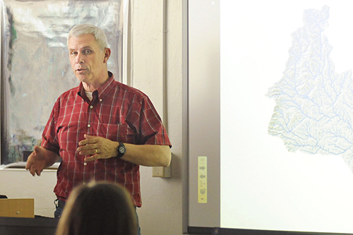
Photo: Rick Loffredo/Highlands University
Joe Zebrowski, director of Highlands University’s new cutting-edge Geospatial Technology Laboratory, teaches a workshop about using the latest geographic information systems (GIS) software tools for hydrologic modeling to the New Mexico Office of the State Engineer. The U.S. Department of Agriculture funded the university’s geospatial technology lab and classroom for advanced map-making applications like 3-D terrain modeling, high-precision global positioning, and GIS. Highlands is the first university in the state to provide this kind of facility for classroom instruction, and faculty and student research. The Geospatial Applications in Natural Sciences (GAINS) grant also funds the latest field instruments used for research on natural resource management topics like soil erosion, water quality, and vegetation. GIS practitioners interested in collaborating with Zebrowski on GIS projects or workshops may contact him at jpzebrowski@nmhu.edu