
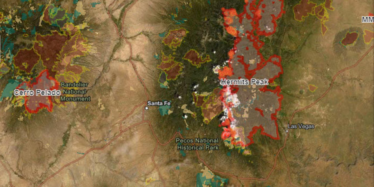
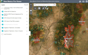
Hot spots, past fires, vegetation treatments and structures are among the web map’s layers.
June 1, 2022
The New Mexico Fire Viewer is an easy-to-use, free web map showing active and past fires in the state. The interactive map was built by Patti Dappen, the Geographic Information Systems program manager at the New Mexico Forest and Watershed Restoration Institute, or NMFWRI. The map is populated with data from satellites and GIS layers showing current and historic wildfires. Viewers can search by active wildfire names to see the perimeters and hot spots, which are updated every few hours from satellite infrared images.
Dappen built the web map in early April, a few days after the Hermit’s Peak Fire began near Las Vegas, NM. Soon, Dappen added the Calf Canyon Fire, Cook’s Peak Fire, Cerro Pelado and others to the map. “We decided to open it up so you can search for any wildfire burning in the state,” Dappen said.
Dappen added a layer that lets viewers see building footprint outlines for structures such as houses and barns and another to show the burn scars from prior fires; the building footprint dataset is from Microsoft. She also added the NMFWRI vegetation treatment web map created by her GIS colleague Katie Withnall at the Institute. Dappen also added a land ownership layer and one to show the evacuation map generated by fire and law enforcement officials.
The building footprint layer only shows structures in relation to fires. It does not show whether a house or other structure has burned. This is determined by property assessments after a fire by other agencies.
The web maps are built on an ArcGIS Online software platform hosted by New Mexico Highlands University. Viewers can click layers in the New Mexico Fire Viewer on and off. They can zoom in to look at details in the layers or zoom out for a broader look. The hot spot information on active fires is updated automatically every four to eight hours, streamed from National Oceanic and Atmospheric Administration satellites. The fire boundary information is updated daily with data provided by the National Interagency Fire Center. Refreshing the map in a browser every few hours will show the latest information. To date, more than 305,000 people have viewed the web map.
Withnall’s vegetation map that she built in the ArcGIS program shows current and historic vegetation treatments including forest thinning, noxious weed removal and prescribed burning. Data on those treatments come from state and federal agencies and landowners. “We collect data from all the other agencies and put it in one place,” Withnall said.
“Using ArcGIS Online we are able to stream fire data from multiple agencies,” Dappen said. “But having it all in one place allows you to make inferences about what’s happening, to help you get a full picture.”
Other data in the web map comes from the New Mexico State Forestry Division, tribes, BLM (Bureau of Land Management), USDA-Forest Service, New Mexico State Land Office and other sources.
The NM Fire Viewer will be available to track future fires in New Mexico. The web map is available at: https://arcg.is/1jC0OS and at https://nmfwri.org. The NM Vegetation Treatment Mapping project can also be viewed at https://nmfwri.org/gis-projects/nm-vegetation-treatment-mapping/