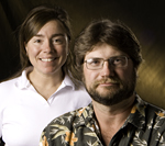
Jennifer Lindline and Michael Petronis
Las Vegas, N.M. — New Mexico Highlands University was awarded a $300,000 U.S. Department of Agriculture grant that will fund a new cutting-edge geospatial technology lab for advanced map making.
Highlands will be the first university in the state to provide this kind of facility for classroom instruction and research.
Geospatial technology includes a wide variety of mapping applications including 3-D terrain modeling, geographic information systems, or GIS, and high-precision global positioning.
The new technology tools will be used for student and faculty research that focuses on natural resource management topics like soil erosion, water quality, vegetation, contaminants in the environment, and more.
“Our main goal with this grant is to graduate students who are practiced and proficient in 21st century geospatial technology, and are poised to address natural resource management issues,” said geology professor Jennifer Lindline, who co-wrote the grant with fellow geology professor Michael Petronis.
Lindline and Petronis are co-directors for the grant.
Geospatial Applications in Natural Sciences, or GAINS, is Highlands’ name for the three-year USDA Hispanic Serving Institution grant. Highlands will purchase the latest geospatial instruments for both fieldwork and lab analysis.
“This grant will also help us build an integrated curriculum using geospatial applications in required geology and forestry classes, as well as advanced courses in these disciplines and other natural resource management courses,” Petronis said. “With the new technology, we’ll be building 3-D computer models that will allow us to track land use changes in real time. This will replace plotting two dimensions on static paper maps.”
Highlands now offers a minor in GIS and a GIS certificate. With the new grant, geospatial technology will be imbedded in all natural resource management courses – knowledge that will give students a competitive edge in the job market as well as advanced academic degree programs.
Joe Zebrowski, a geographic information systems expert with nearly 30 years of experience, will direct the new geospatial technology lab at Highlands. He is a GIS instructor at Highlands and is also a GIS specialist for the New Mexico Forest and Watershed Restoration Institute at Highlands.
Lindline said an important goal of the grant is to retain students who are interested in studying geology and forestry but are unprepared in math and science. The grant funds more tracking of student progress, and referral to skill-building services like workshops at ARMAS, the university’s Achieving in Research Math and Science Center.
“Research shows that incorporating more GIS content into geology and forestry classes actually improves students’ math and spatial skills,” Lindline said.
Some other elements of the USDA grant include:
• Paid summer GIS internships connecting students with natural resource management agencies such as the U.S. Forest Service and the New Mexico Office of the State Engineer.
• Advanced GIS training for natural resource management faculty that Zebrowski will provide.
• A $45,000 scholarship that will be awarded to an Hispanic American student at Highlands who is a sophomore or junior majoring in geology or forestry.
The deadline for students to apply for the grant-funded scholarship is Sept. 26. Interested students may contact Lindline at 505-426-2046 or lindlinej@nmhu.edu or Petronis at 505.454.3153 or mspetro@nmhu.edu
